This year my wife Tricia fell and broke her neck! Luckily, she lived through it with no nerve damage,

But.. It requires lots of specialized physical therapy (PT).

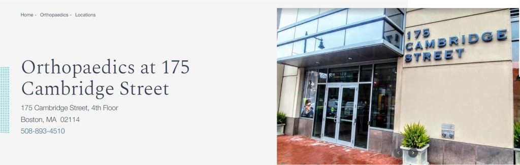
So, Every week we leave Hingham for Mass General Hospital and the Physical Therapy group at 175 Cambridge Street.
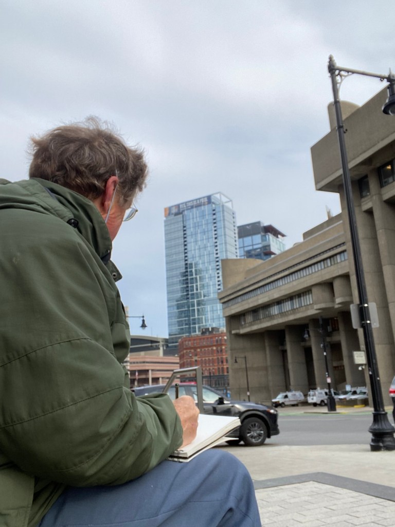
We park the car at MGH, walk up Cambridge Street and then while Tricia gets PT, I can walk around the “West End’ around MGH. Here’s a view of a simple 1 mile walk.

The first day I took a short walk from the PT clinic over to Staniford Street and found a great set of benches with a view to sketch the scene looking downhill down Staniford S.
This view blended three architectures: at the center a beautiful late “Victorian Commercial” brick building from the 1880’s, to the right a concrete “brutalist” architecture building –the Health, Welfare and Education Service Center named “Joseph A. Langone, Jr., Memorial Center” — designed in the 1960’s by Paul Rudolph , and beyond both a conventional floor-to-ceiling blue-ish glass box from the 2010’s at 84 Causeway Street.

I could see these weekly trips to MGH could become fun sketching tours.
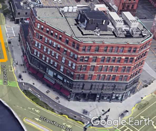
The next week I moved closer to the older building at the base of Staniford St.
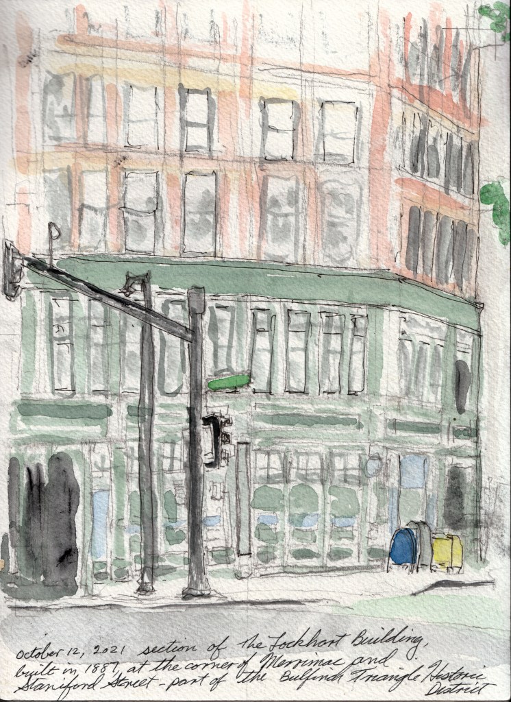
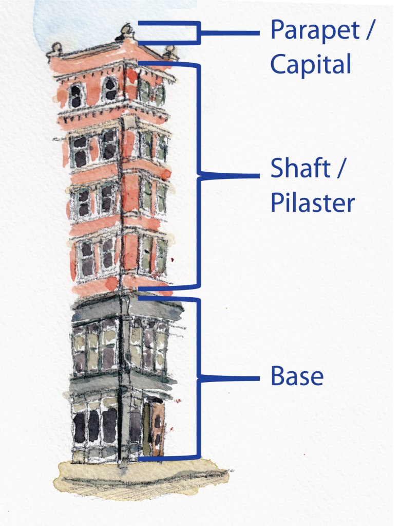
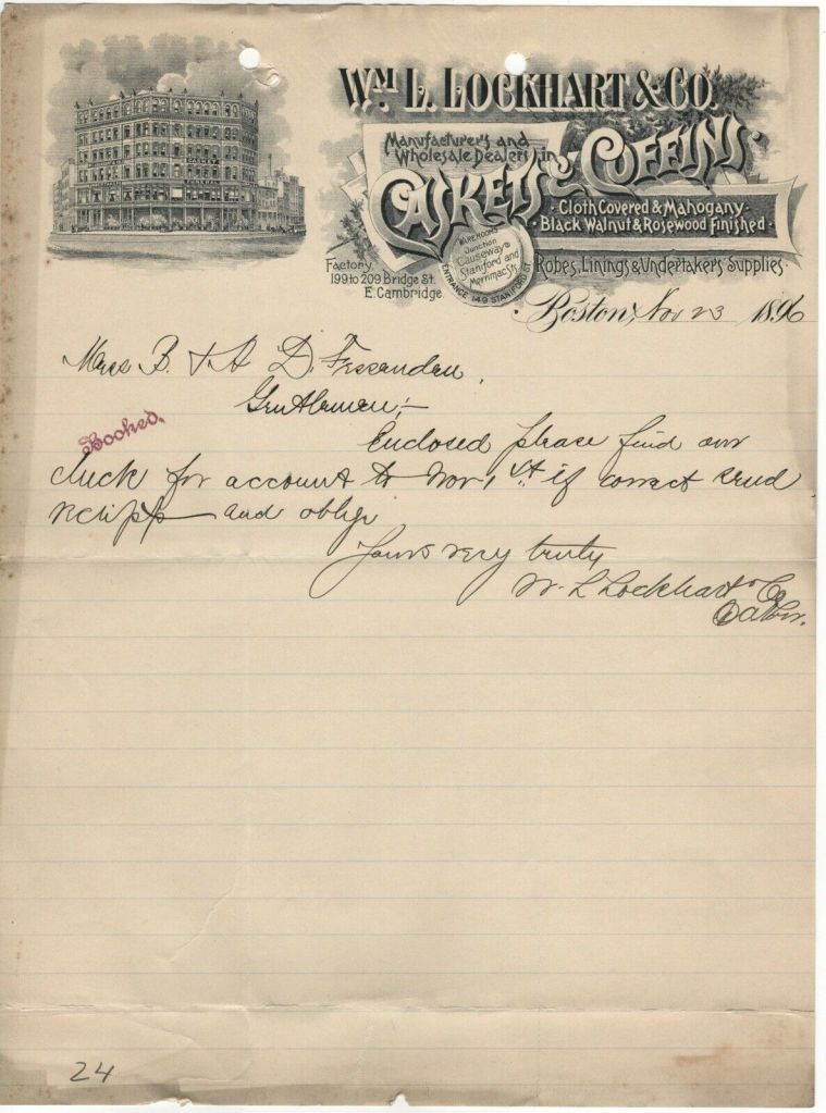
The brick building was the Lockhart Building built in 1887 for a leading wholesaler of coffins and funeral supplies! Amazing. It matches the Victorian Commercial style which the St. Louis MO Preservation Plan explains (as they describe St. Louis’ Merchants Laclede Building, at 408 Olive, a parallel to the Stockwell Building) is…
…an early attempt to organize exterior elements of a tall office building as if it were a giant column, with articulated base, shaft and capital. … The first two stories (the base) are [glass and iron / shops and storefront], … upper stories in brick. The verticality of the “shaft” is emphasized with pilasters that extend from the third story to the [sixth] parapet…”.
St. Louis Missouri, Heritage and Urban Design Division (now the Cultural Resources Office) (1995), “A Preservation Plan for St. Louis – Part II: Property Types Period 2 – The Victorian City and the Street Car (1870-1900)”, Retrieved from https://www.stlouis-mo.gov/government/departments/planning/cultural-resources/preservation-plan/The-Victorian-City-Commercial-Structures.cfm
on January 29, 2022 with additions and elisions to match Lockhart by John Daly
The US National Register of Historic Places Inventory—Nomination Form for the Bulfinch Triangle (‘Nomination’) explains that, “The usual layout of these new structures consisted of storefront shops and showrooms on the first and second floors surmounted by office and warehouse space on the upper stories.” Architects call the style of this Lockhart Building “Victorian Commercial.”
Also the building fits an unusual plot as it contours the curves of Merrimac, Causeway and Staniford Street with four separate wall planes to face and flow with the streets.
In the Commonwealth of Massachusetts’ nomination of the area for the National Register of Historic Places Susan Hollister notes that,
The diagonally-oriented Merrimac Street … creates several irregularly-shaped lots whose buildings add diversity to the area. [A] noteworthy example[ ] of this type ..[is] the Lockhart Building (137 – 149 Merrimac Street, 1887) which dominates one edge of the district by wrapping around the corner of Merrimac and Causeway Streets. “
Hollister, Susan – Architectural Conservation Trust (March 1985). United States Department of the Interior, National Park Service, National Register of Historic Places Inventory—Nomination Form – Bulfinch Triangle Historic District.
Then just down Causeway Street another building at the corner of Causeway and Portland Street caught the eye.

According to the Nomination Document, This “91-97 Causeway St. w/203 Portland St. H. Hollis Hunnewell Block ” built in 1885 fits with the Richardsonian-influenced commercial style. That is Henry H. Richardson the architect of Trinity Church Boston and other such. Late in his career Richardson…
..refined his architectural style through the simplification of form and the elimination of extraneous ornament and historical detail. His buildings – monumentally heavy, yet simple in line – incorporated semicircular arches, towers and rusticated brick facades.”
Collins, N. (n.d.). Henry Hobson Richardson: Biography. Visual Arts Encyclopedia. https://www.visual-arts-cork.com/architecture/henry-hobson-richardson.htm
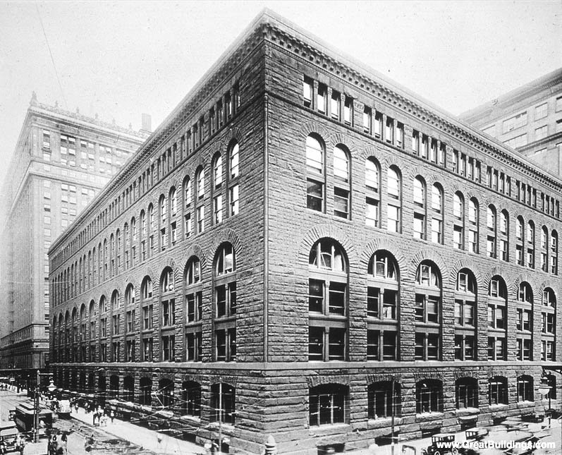
Architects see this Marshall Fields Store in Chicago as an example this commercial adaptation of his style. The Hunnewell Block reflects this style.
As mentioned the National Park Service has designated this little 5 acre triangular area as an historic, architecturally significant district — the “Bulfinch Triangle Historic District.” The Boston Planning & Development Agency manages this district and controls aspects building height, sustenance of existing facades and it reviews building plans to keep the district looking as it was.

In the 1700’s the area was an estuary opening to the harbor / Charles River. A Causeway and mill had dammed it up.

By the mid-1640s, millers who had been granted water rights to the North, Cove had begun changing the shoreline by damming the cove at its mouth (Causeway Street), an alteration that turned the marshy estuary basin into a large mill pond. As Boston continued to grow over the next century, land on the narrow peninsula became more .scarce and citizens resorted to creating land by filling in the waterfront. In 1804, the North Cove mill owners formed a corporation and petitioned the city for permission to fill the cove. An agreement was reached and Charles Bulfinch provided a plan for the layout of the new 50-acre area. The resulting design was triangular in shape, with the base along Causeway Street and the apex at Haymarket Square.”
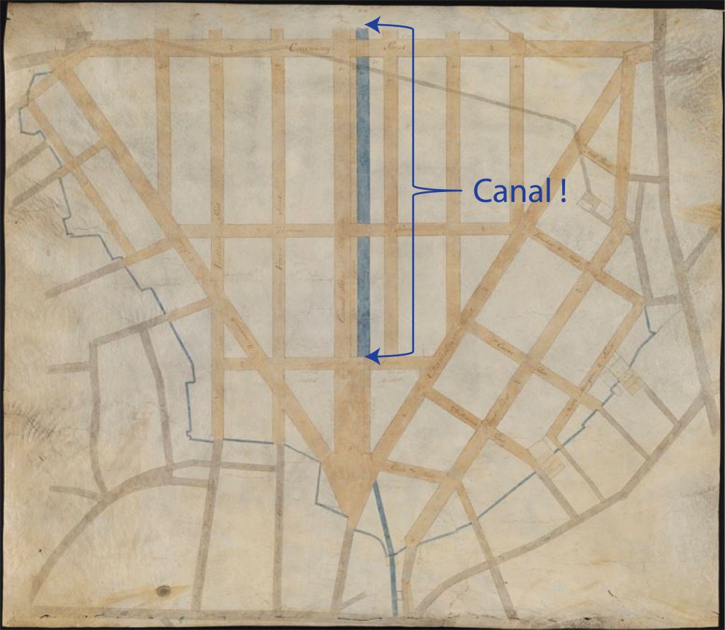
The filling of the mill pond, begun in 1807, was a monumental project that was accomplished through the partial levelling of nearby Beacon [cut from a height of 138 feet to only 80 feet of elevation] , Cotton, and Copps Hills. The completion of the land-fill coincided with the establishment of the railroads in the mid:1830’s, a circumstance that shaped the area’s development.
Hollister, S. (1985, March). United States Department of the Interior, National Park Service, National Register of Historic Places Inventory—Nomination Form – Bulfinch Triangle Historic District. https://catalog.archives.gov/OpaAPI/media/63796782/content/electronic-records/rg-079/NPS_MA/86000274.pdf. Retrieved January 30, 2022, from https://catalog.archives.gov/OpaAPI/media/63796782/content/electronic-records/rg-079/NPS_MA/86000274.pdf
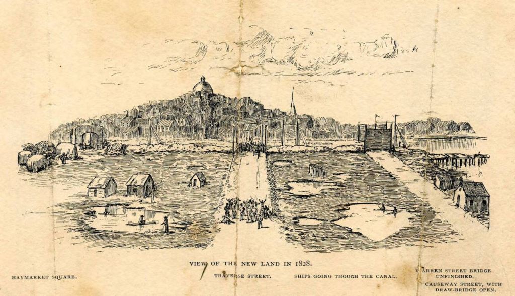
Haymarket Square. Traverse Street. Ships going through the Canal. Warren Street Bridge Unfinished. Causeway Street with Draw Bridge Open. https://commons.wikimedia.org/wiki/File:View_of_the_new_land_in_1828,_Boston.JPG. Retrieved January 31, 2022,
By the early 1870s, the proximity to railroad transportation also encouraged the district’s growth as a center for furniture manufacturing and sales, just as other specialized businesses (leather, textiles) concentrated in the vicinity of South Station.
Hollister, S. —Nomination Form
The Lockhart coffin and casket company likewise located here for easy access to shipping / transportation via railroad.
Here’s how it looked in 2000 before they took down the elevated trolley line:

The Triangle also features a number of examples of “Second Empire” Style buildings. The style came from France where Emperor Napoleon III directed his prefect of Seine, Georges-Eugène Haussmann, to rebuild Paris into a beautiful city between 1853 and 1870. The rebuild featured apartment buildings with, among other features, ground floor and basements with thick, load-bearing walls, fronts usually parallel to the street housing shops and offices, a mansard roof, angled at 45°, with garret rooms and dormer windows. (Wikipedia on Rebuild of Paris)
Americans adopted this style in earnest from 1855 to 1885. The 1857 Triangle Building at 130-132 Portland Street offers an intact superb example of the style and, according to the Nomination, “exhibits wooden capped lintels, a wooden bracketed cornice, and a scalloped slate mansard roof.”
It sits in front of of what architects call a “Beaux Arts” — named after the French school of architecture, the Ecole des Beaux-Arts, and according to the Pennsylvania Architectural Field Guide — building at 134 – 142 Portland Street. Per the Nomination, “an especially fine feature of the building are its ox-eye windows set in curved limestone surrounds at rounded corner bays.” [Evident in the sketch]
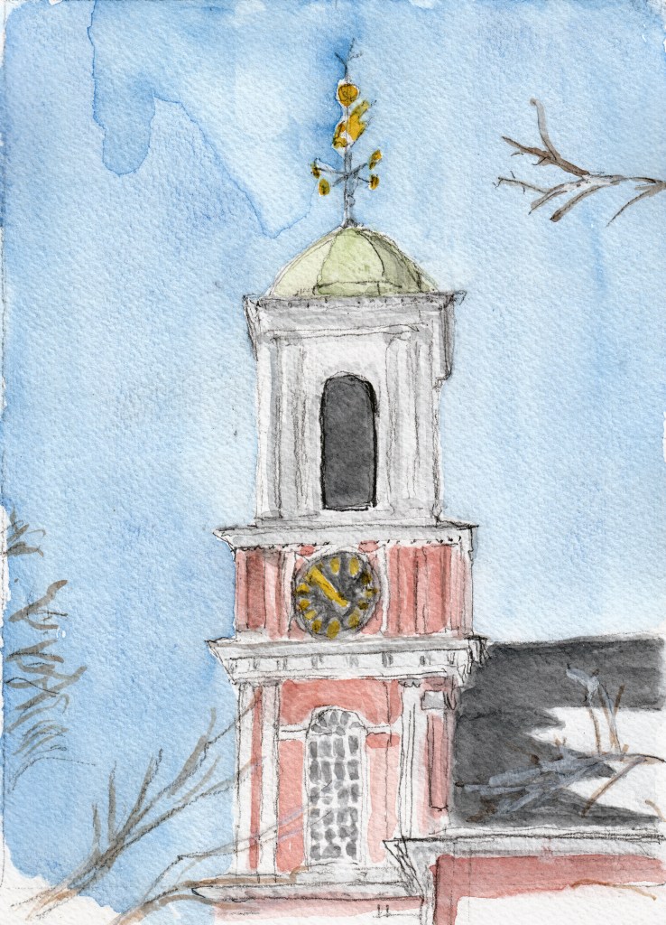
Moving back up New Chardon Street by the Court House and Government Service Center towards Beacon Hill we come back to the corner of Cambridge and Staniford street and the Old West Church. The original West Church built in 1737 was the highest point in Boston. British General Gage had its steeple removed in late 1774 or 1775 to prevent patriots signaling the country side.

Retrieved January 30, 2022, from https://collections.leventhalmap.org/search/commonwealth:7h149z785
Thus with West Church spire razed, Paul Revere arranged to use the lower but still visible Old North Church for his lantern signals — “one if by land…”
Asher Benjamin designed this second Old West church and spire in the Federal (Adam) style in 1806.
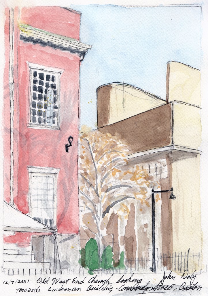
Looking from the front Churchyard of Old West towards the east and to the Government Service Center’s bastions gives this contrast of early 1800’s Federal with 1960’s Brutalist.
and then from the same spot in the Old West church yard I turn to the right and southwest to look through the wrought iron churchyard fence at the base of Hancock St. that leads right up Beacon Hill to the state capital building.
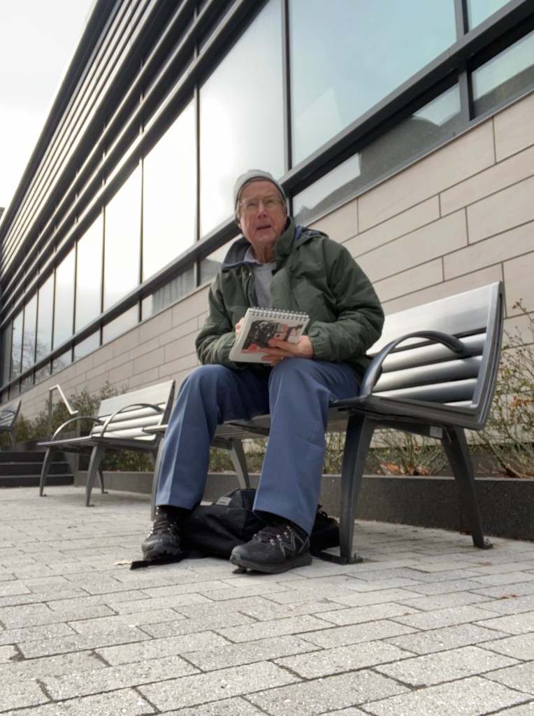
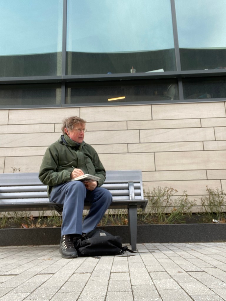
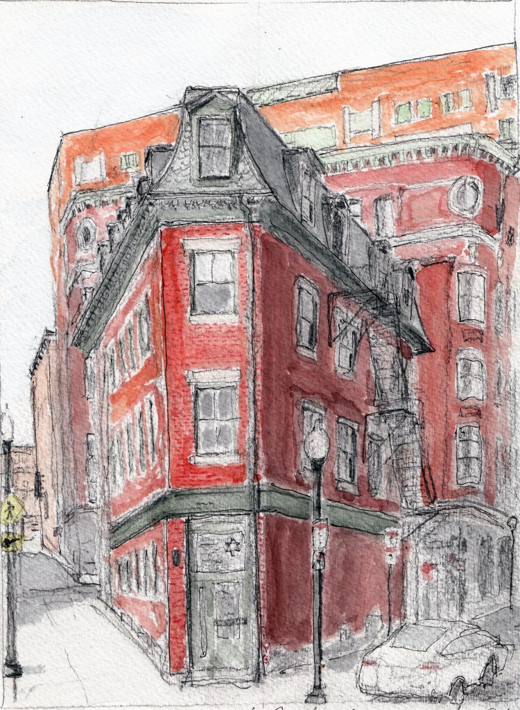
Heading back down to 175 Cambridge St I wait sitting just outside looking to the left at a few buildings at the base of Beacon hill
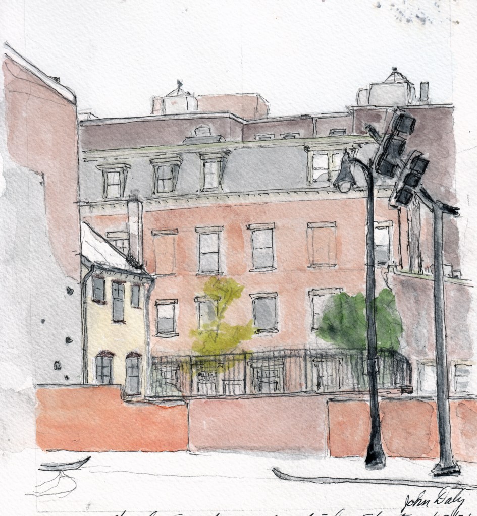
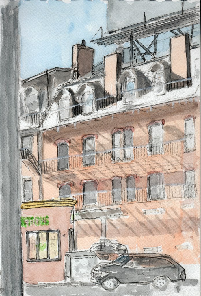
and then turning right to a few others with Mansard roof and fire escapes everywhere.
Tricia Joins me and we head back to Hingham.
Here’s a fly by video version of the same tour.
Thanks for reviewing and I hope you get a chance to walk it.
